
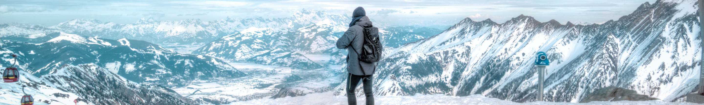
DEO TIBBA
- 12 Days and 11 Nights
- Pir Panjal Range near Manali
From : ₹55000
Request a callback
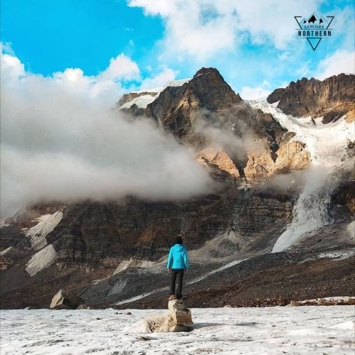
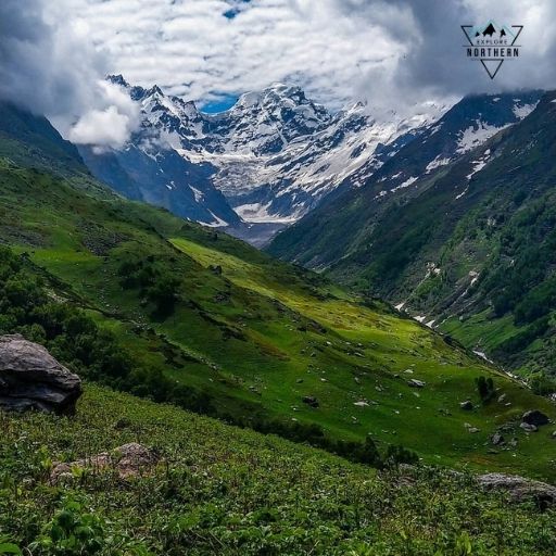
Deo Tibba, located in the Pir Panjal Range near Manali, stands at an impressive height of 5,985 meters. Situated southwest of Manali and above the village of Jagatsukh, it is known as a sacred peak where the Devtas (Gods) were believed to have gathered. This expedition offers a thrilling adventure, with challenging snow-covered routes and high-altitude terrain, making it an ideal trek for adventure enthusiasts and experienced climbers.
Best Time to Visit
• Summer: May to June
• Autumn: September to October
Monsoon and winter seasons are not ideal due to snow accumulation and weather conditions.
Deo Tibba Weather
• Summer (May - June): Daytime temperatures range from 7°C to 18°C; nighttime temperatures can drop to -3°C.
• Autumn (September - October): Daytime temperatures range between 5°C and 20°C; nighttime temperatures can drop to -8°C.
The weather remains relatively cold with snow at higher altitudes, especially in the summit region.
Difficulty Level
This expedition is ideal for experienced trekkers and climbers, requiring good physical fitness, stamina, and knowledge of technical gear. The trek involves challenging snow-covered terrain and high-altitude conditions.
- Expert Acclimatization: Our gradual acclimatization process ensures a safe summit journey.
- Safety First: Certified guides, first aid, and top-quality gear for high-altitude safety.
- Energy-Focused Meals: Experienced, local guides familiar with the terrain.
- Environmental Responsibility: We follow eco-friendly practices to preserve nature.
Itinerary
- Altitude Gain: 2200 Meter / 3500 Meters
- Drive Distance: 15 km
- Trek Distance: 8 km
- Trek Duration: 2 to 3 hours
- Trail Type: Initially forested, transitioning to grasslands
- Difficulty Level: Moderate to Challenging
- Water Sources: Ample water sources
Overview:
Start your adventure with a drive to Khanol, followed by a trek to Chikka. The journey is filled with beautiful sceneries, lush forests, and colorful houses along the way. The trek will be moderately challenging with a slight incline, leading to Chikka, a picturesque village nestled among oak and deodar trees. The campsite at Chikka offers spectacular views of Deo Tibba, Spiti Valley, and Indrasan Peak.
- Altitude Gain: 750 Meter / 2400 Feet
- Trek Distance: 7-8 km
- Trek Duration: 5.5 to 6 hours
- Trail Type: Forests, meadows, and boulders
- Difficulty Level: Moderate
- Water Sources: Sufficient water
Overview:
The day begins with a trek through Jagatsukh Nallah, passing through dense forests and scattered meadows. The journey continues through rocky sections, leading to Seri alpine meadows. Afterward, we set camp at Panduropa, where you can enjoy stunning views of Norbu, Malana Pass, Jagatsukh, and Deo Tibba Peak.
• Altitude Gain: 650 meters / 2200 feet
• Trek Distance: 8 km
• Trek Duration: 5-7 hours
• Trail Type: Grasslands and steep climbs
• Difficulty Level: Challenging
• Water Sources: Adequate
Overview:
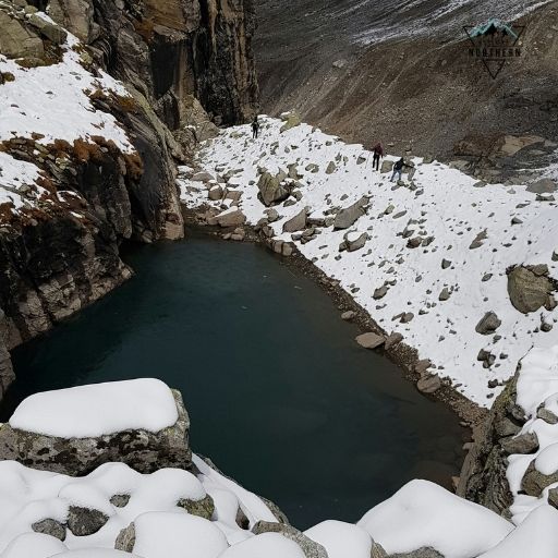
Today's trek follows the Jagatsukh river and leads to a steep climb toward the moraines. After crossing this section, you will reach Tainta Camp, the base camp for the climb. A visit to the nearby Chota Chandratal is planned before returning to Tainta Camp for the night.
- Altitude: 4200 meters
- Overview:
At this height, it's essential to acclimatize. Spend the day resting, exploring Chota Chandratal, or relaxing in camp. A briefing session will also be held in the evening to discuss the upcoming stages of the trek.
• Altitude Gain: 600 meters / 2000 feet
• Trek Distance: 0.6 km
• Trek Duration: 4 to 5 hours
• Trail Type: Moderate to steep climbs
• Difficulty Level: Challenging
• Water Sources: Carry enough water
Overview:
This is a load ferry day, where you'll climb to a higher altitude to help prepare for the summit, then return to base camp to sleep at lower altitudes. The trek includes moderate and steep sections, and extra care is needed due to slippery surfaces and deep cracks.
• Altitude Gain: 600 meters / 2000 feet
• Trek Distance: 0.6 km
• Trek Duration: 4 to 5 hours
• Trail Type: Moderate to steep climbing
• Difficulty Level: Challenging
• Water Sources: Carry enough water
Overview:
Follow the same route as the previous day to reach Camp 1. This trek is steep and requires careful navigation, especially through rocky and icy patches.
• Altitude Gain: 500 meters / 1600 feet
• Trek Distance: 4 km
• Trek Duration: 4 to 5 hours
• Trail Type: Snow-covered areas
• Difficulty Level: Moderate to Challenging
• Water Sources: Carry hot water
Overview:
This load ferry day involves a moderate climb to Summit Camp, followed by a return to Base Camp 2. Be cautious of slippery surfaces and cold weather conditions, which may lead to altitude-related challenges.
- Altitude Gain: 500 meters / 1600 feet
- Trek Distance: 4 km
- Trek Duration: 4 to 5 hours
- Trail Type: Snowy terrain
- Difficulty Level: Moderate to Challenging
- Water Sources: Carry hot water
Overview:
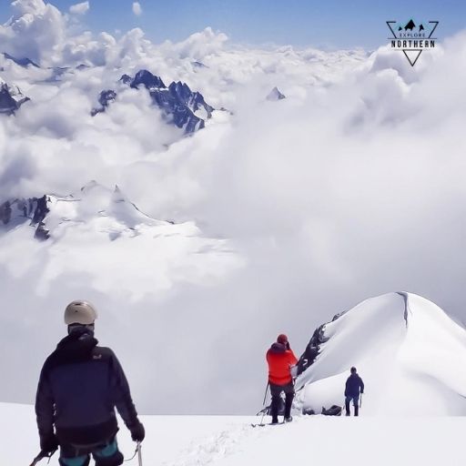
This is the summit attempt day. Be prepared for slow and steady movement due to the snow-covered terrain and thin air. The return journey to Base Camp 2 will be necessary due to altitude-related risks.
- Altitude Gain: 400 meters / 1300 feet
- Trek Distance: 6 km
- Trek Duration: 4 to 6 hours
- Trail Type: Steep sections followed by a flat summit walk
- Difficulty Level: Challenging
- Water Sources: Carry adequate water
Overview:
The summit attempt begins early in the morning, with the first few kilometers being a steep climb. The last section is a flat walk to the summit, where you will rest before returning to Base Camp 2 due to altitude challenges.
- Altitude Loss: 600 meters / 2000 feet
- Trek Distance: 3 km
- Trek Duration: 3 to 4 hours
- Trail Type: Steep descent
- Difficulty Level: Moderate
- Water Sources: Ensure sufficient water
Overview:
The return journey begins. Move slowly on the steep descent to avoid injury and reach Base Camp 1 for the final night of camping.
- Altitude Loss: 1400 meters / 4600 feet
- Trek Distance: 16 km
- Trek Duration: 6 to 8 hours
- Trail Type: Mixed descent (steep and flat)
- Difficulty Level: Moderate
- Water Sources: Ample water sources
Overview:
Enjoy the final stretch of the trek as you descend back to Chikka. This day is about savoring the last night under the stars in your tent.
• Altitude Loss: 1050 meters / 3450 feet
• Trek Distance: 5 km
• Trek Duration: 2.5 to 3 hours
• Drive Distance: 12 km
• Drive Duration: 1 hour
• Trail Type: Easy
• Difficulty Level: Moderate
• Water Sources: Numerous water sources
Overview:
The final leg of the journey takes you back to Manali. Take care on your last trek to Khanol before your drive back. It’s time to bid farewell to the mountains!
Included/Excluded
-
Comfortable stay in alpine tents
-
Permits and entry fees
-
Trekking insurance
-
Hygienic meals (vegetarian and eggs available)
-
Certified climbing instructors
-
Transportation (Manali to Khanol and back)
-
Oxygen cylinders and first aid kit
-
Technical equipment (climbing ropes, helmets, ice axes, etc.)
-
Stay on the last day in Manali hotel
-
Personal trekking gear (shoes, jacket, etc.)
-
Offloading of backpacks (additional charges)